Lithuanian case - Relict forest area
The Public Institution Coastal Research and Planning (CORPI) and Klaipéda University are exploring the relic forest area and wrecks in Lithuania.
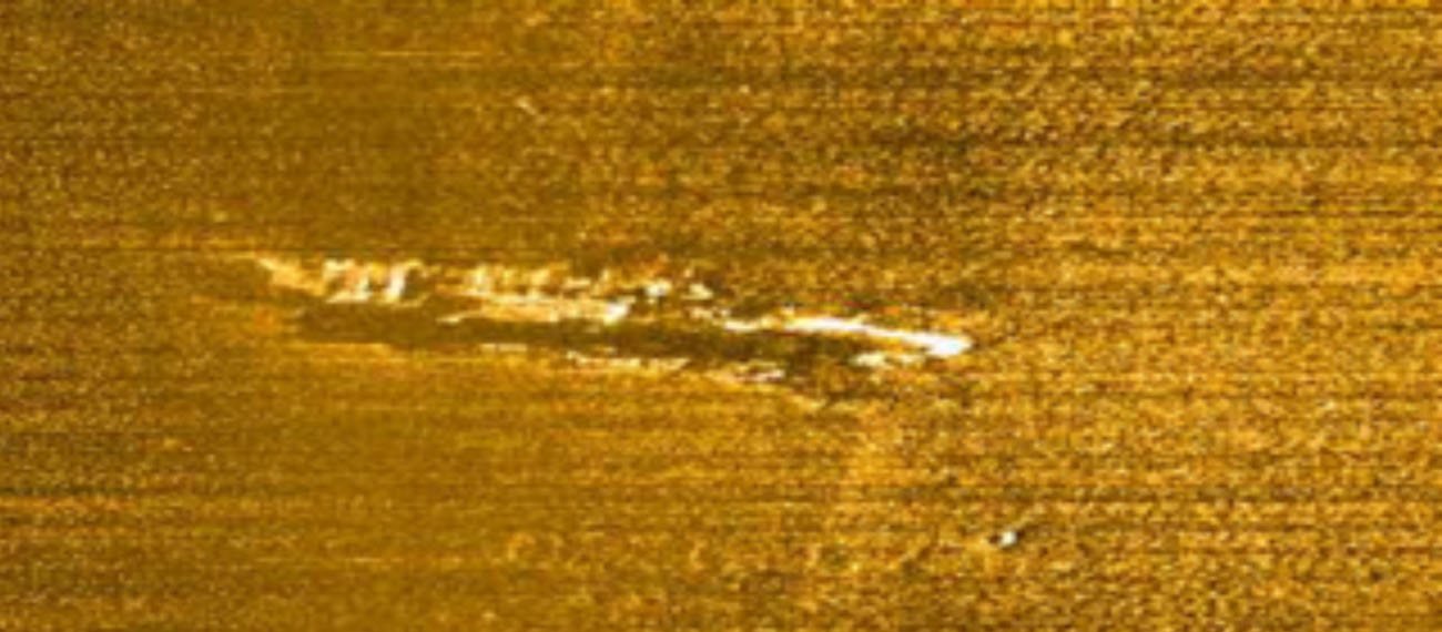
Category: Underwater landscape and wrecks
Site description (Relict forest area)
Main characteristics:
- Well-preserved remains of „relict forest“;
- Trees and peat are found at the depth of 24.5 to 29 meters;
- 477 samples collected, of those - 109 objects were identified as likely to be remains of trees;
- Dating of the remains shows the age of 11410–10170 cal. BP (9640–8220 cal. BC) and 9150-8520 cal. BP (7200–6570 cal. BC);
- Dates evidences that underwater landscape with pine forests and small lakes existed before the transgression of Ancylus Lake stage of the Baltic Sea;
- There is suspicion that area during the Yoldia Sea and Ancylus Lake periods have been settled by the Mesolithic inhabitants– early Mesolithic Kunda culture (Pulli stage), and – Maglemose settlers.
Applied methods:
- ~30 km2 sea bed area has been scanned by the side-scan sonar and multi-beam echo-sounder;
- Radiocarbon dating;
- Inspected by divers.
Site description (Wrecks)
Main characteristics:
- WRACK 23 (W-23). Position: 55º 31'.758 N; 020º 54'.541 E. Depth: ~36 m.; distance from shore of Juodkrantė ~ 7.5 sea miles; Part of a relatively well-preserved wooden ship’s hull. Three-mast bark, length ca 52 m, and the beam ca 10.5–11 m. Age of the wreck: most likely the second half of the 19th c.
- WRACK 24 (W-24). Position: 55º 30' 1855 N; 021º 00' 9887 E. Depth: 22-24 m. Metal-hulled wreck. Length ca 30 m. The hull was destroyed by an explosion. Age: 20th c.
- WRACK 25 (W-25). Position: 55º 30' 3496 N; 021º 00'.7683 E. Depth 27-30 m. Metal-hulled wreck. The bow and middle of the wreck are destroyed by an explosion. Age: 20th c.
- WRACK 31 (W-31). Position: 55º 30'.130 N; 020º 57'.519 E; Depth 32 m. Metal-hulled wrack. Length ca 31 m, beam ca 5,7 m. Fishing boat. Age: 20th c.
- WRACK 37 (W-37). Position: 55º 30.625 N; 020º 59.310 E; Depth 25 m. Metal-hulled wrack. Well preserved fishing boat. Age: 20th c.
- WRACK 37A (W-37A). Position: 55º 30 601 N; 020º 59 301. Depth 25-29 m. Metal-hulled wrack. The hull was severely destroyed. Age: 20th c.
- WRACK 53 (W-53). Position: N 55‘31‘395; E 020‘57‘947 at the distance of 5 sea miles from the shore of Juodkrantė. Depth 29 m. German cargo ship (steamer) Anna Katrin Fritzen (1938–1942), ex Gerda Kunstmann (1914), ex Vulcan (1911). Sank on 5 July 1942. The hull is destroyed by torpedo explosion.
Applied methods:
- Scanned by the side-scan sonar;
- Inspected by divers, provisionally measured, photographed and video-recorded.
Legal status/Presence the national register of cultural heritage: None/Not registered in the official list of national cultural heritage.
Representation in the national planning documentation: Area is marked in the Lithuanian MSP as a potential UCH site.
Planned activities
- Filed studies in the area including multi beam echo-sounder and side scan survey, diving- visual inspection;
- Precise delineation of the valuable area and comprehensive description of the assets as well as MSP applicable categorization;
- Preparation of regulatory framework for the potential UCH site;
Expected results
- UCH(Underwater Cultural Heritage) assets introduced in the National Register of cultural heritage;
- UCH site established;
- UCH site regulatory framework developed and approved by managing authority (Ministry of Culture);
- UCH site introduced in the second edition national MSP.
